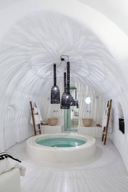
50m²
Honeymoon Suite
Cave suite with caldera-facing veranda, designed for couples and milestone trips.
View room
Travel Guide
By Fanis Kafouros, Owner since 2006 · Published · Updated
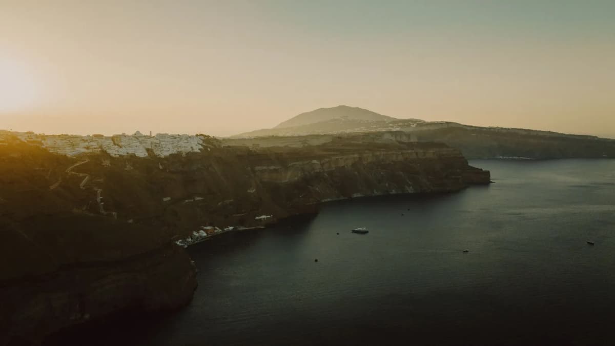
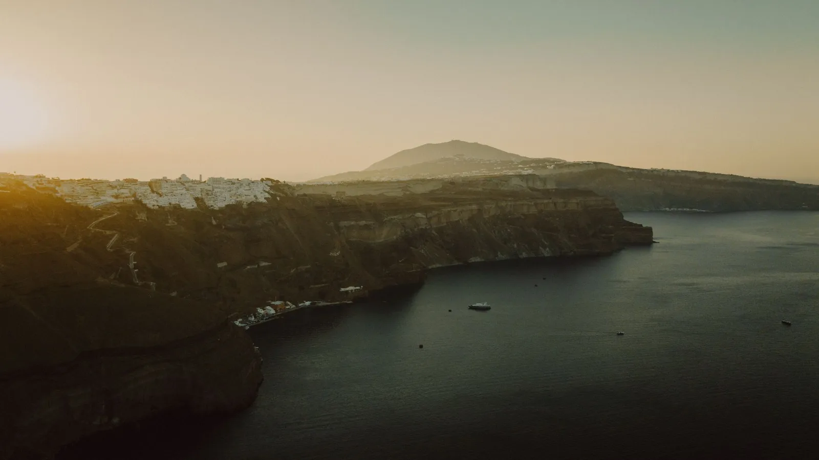
Santorini's caldera is the reason this island looks the way it looks. It is the reason the photos make people stop scrolling. It is the reason you can sit on a balcony 300 meters above the sea and look down into deep blue water.
Quick Answer: The Santorini caldera is a flooded volcanic crater roughly 12 km long, 7 km wide, and up to 400 meters deep. It was created by one of the largest volcanic eruptions in recorded human history, the Minoan eruption around 1600 BC, which collapsed the ancient island of Strongyli into the sea. It's widely described as the only continuously inhabited sea-caldera in the world, with the modern villages of Fira, Imerovigli, and Oia perched on the cliff rim. The best places to see it are anywhere along the western cliff edge, or from a catamaran cruise inside it.
Santorini's caldera is the reason this island looks the way it looks. It is the reason the photos make people stop scrolling. It is the reason you can sit on a balcony 300 meters above the sea and look down into deep blue water. It is also the reason there is a Santorini at all: the modern island is the rim of a collapsed volcano, half-submerged in the Aegean, with everything we walk on perched on the edge.
This is a guide to what the caldera actually is, how it formed, where the best places to see it are, and why it matters for everything from the architecture to the sunsets to the wine. Written from a hotel built into the caldera cliff in Fira.
This article is part of our Santorini travel guide.
The word comes from the Spanish for "cooking pot." A caldera is the bowl-shaped depression left behind when a volcano collapses in on itself after a massive eruption. It is not a regular crater (which is the rim of a cone). A caldera forms when the magma chamber below a volcano empties so quickly that the ground above it has nothing left to support, and the whole mountain falls in.
When a caldera is below sea level (or low enough that the sea can flood it), you get a submerged basin like Santorini's. This is rare. Most calderas worldwide are inland (Yellowstone, the Phlegraean Fields near Naples, Crater Lake in Oregon). A flooded sea-caldera, with people living on the rim, is essentially unique to Santorini.
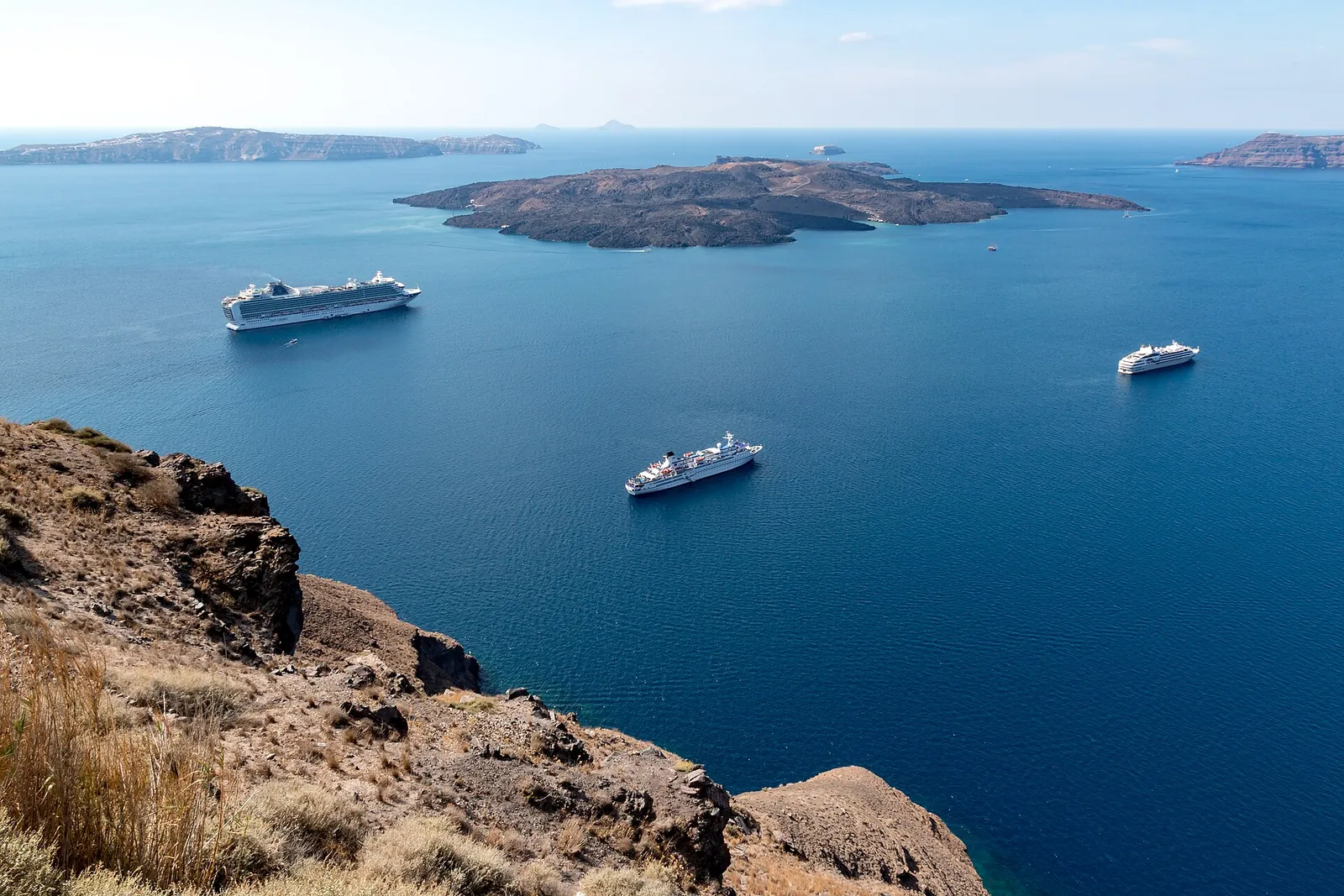 Photo: Dietmar Rabich, CC BY-SA 4.0, via Wikimedia Commons
The story goes back at least 400,000 years, through dozens of volcanic cycles. The caldera we see today was formed by the most recent major eruption, the Minoan eruption, around 1600 BC.
Before the eruption, there was a single circular island here called Strongyli ("the round one" in ancient Greek). It had a mountain at its center, with a town called Akrotiri on its southern flank, a thriving Minoan Bronze Age society.
Around 1600 BC, the volcano erupted in what scientists rank as one of the largest eruptions of the past 10,000 years. Roughly 30 to 60 cubic kilometers of magma were ejected. (For comparison, the 1980 Mount St. Helens eruption ejected about 1 km³.) The magma chamber emptied, the mountain collapsed, the sea rushed in to fill the void, and what remained was the crescent-shaped islands of Thira (Santorini), Thirassia, and Aspronisi, with a flooded basin between them.
The buried Bronze Age town of Akrotiri was preserved under 50 meters of ash. The eruption triggered tsunamis that reached Crete and may have contributed to the collapse of the Minoan civilization itself.
Modern Santorini is still volcanically active. Two small islands in the middle of the caldera, Nea Kameni and Palia Kameni ("new" and "old burnt"), are recent volcanic cones that emerged from the seabed in eruptions between the 1500s and the 1950s. You can walk the crater rim of Nea Kameni on a volcano tour and feel the heat from sulfur vents.
| Metric | Value |
|---|---|
| Caldera length (north-south) | ~12 km |
| Caldera width (east-west) | ~7 km |
| Maximum depth from cliff top to seabed | ~700 m (cliffs up to ~300 m, water up to ~400 m deep) |
| Water depth in caldera | up to ~400 m |
| Cliff height above sea | up to ~300 m |
| Year of Minoan eruption | ~1600 BC |
| Volume of magma erupted | ~30-60 km³ |
| Total area | ~83 km² |
Source: data compiled from volcanological surveys including the Greek Institute for Geology and Mineral Exploration, and University of Athens publications.
The whole western cliffside of Santorini is one continuous view of the caldera. The classic spots:
You are literally on the rim. The main caldera path runs through Fira, north toward Firostefani, Imerovigli, and Oia. Our hotel is built into the cliff face here. Every west-facing room and every public terrace looks straight down into the caldera, with Thirassia island opposite and Nea Kameni in the middle. For more on Fira specifically, see our Fira guide.
The northern tip of the rim. The view from Oia takes in the northern arc of the caldera and the back of Thirassia. This is the famous sunset view, with the sun dropping into the open Aegean. See our Oia sunset without crowds for the practical version.
The highest point on the caldera rim, with Skaros Rock jutting out into the basin. Many photographers consider this the best caldera view on the island. See our Imerovigli guide.
A catamaran cruise is the easiest way to be inside the bowl, looking up at the cliffs. You see the layered geology in the cliff face, multiple eruption deposits stacked like a layer cake. The cruise stops at Red Beach, White Beach and the hot springs. If you want to walk on the volcano itself, that's a separate volcano tour to Nea Kameni.
Limited but available. Some operators fly caldera tours by helicopter. One operator, Glacier Heli, lists a 20-minute shared flight from EUR 295 per person and a 30-minute flight from EUR 445 per person, with private flights priced on request. From the air you see the whole ring of the caldera at once, with Nea Kameni in the middle.
A note on the east coast: from Kamari, Perissa or Vlychada you don't see the caldera at all. That side faces the open Aegean, away from it.
It is not just the view. The caldera defines Santorini's whole character:
Geology and soil. Volcanic soil grows the famous Assyrtiko wine, the sweet cherry tomatoes, the white eggplant, and the Santorini fava (yellow split peas). The Assyrtiko wines of Santorini are minerally because the vines are rooted in pumice.
Architecture. Cave-style houses are dug into the soft pumice cliff. Our cave suites use the same building tradition: cool in summer, warm in winter, arched ceilings carved into the cliff face. See our cave hotel guide and jacuzzi cave suite.
Sunset. The west-facing cliff is what makes Santorini's sunset famous worldwide. The caldera frames the sun as it drops into the sea.
Tourism. Most visitors come for this view, and most of the island's cave houses and cliff paths exist because of it. Our Santorini tourism statistics put numbers on how many people come for it.
Living on a volcano. Small earthquakes happen multiple times a year. In early 2025 a stronger earthquake swarm out at sea between Santorini and Amorgos led to a state of emergency from 6 February to 3 March 2025, and a few access rules for the harbours and paths below the cliffs still apply. Our Santorini safety guide has the details and sources. The 1956 Amorgos earthquake (magnitude 7.7) destroyed much of Fira. Most cave houses are built to flex. The volcano under Nea Kameni is monitored constantly by the Institute for the Study and Monitoring of the Santorini Volcano.
The caldera-edge villages (Fira, Firostefani, Imerovigli, Oia) all offer caldera-view accommodation, and prices reflect it. Genuine caldera-view rooms run higher than rooms on the back side or in the interior of villages.
Our hotel is built directly into the Fira caldera cliff. All west-facing suites look straight down into the basin. Our honeymoon suite and private villa each have their own balcony on the hotel's connected cliffside terraces, overlooking the caldera and Thirassia. For a deeper guide to the village choices, see our caldera-view hotel article.
The Santorini caldera is a flooded volcanic crater roughly 12 km long and 7 km wide, formed by a massive volcanic eruption around 1600 BC. The ancient island of Strongyli collapsed into the sea after the eruption emptied its magma chamber, leaving the modern crescent-shaped islands of Santorini, Thirassia, and Aspronisi as the rim, and the deep flooded basin in between.
The water inside the caldera reaches depths of about 400 meters. Combined with cliffs up to about 300 meters above sea level, the total vertical drop from cliff top to seabed is around 700 meters. This makes it one of the deepest caldera basins in the world.
Yes. Santorini is part of the South Aegean Volcanic Arc and is still considered an active volcanic system. The most recent significant eruption was in 1950 at Nea Kameni, the small island in the center of the caldera. The volcano is continuously monitored. Most activity is currently dormant, with occasional small earthquakes and sulfur emissions at Nea Kameni. In early 2025 an earthquake swarm at sea between Santorini and Amorgos led to a month-long state of emergency (6 February to 3 March 2025). See our Santorini safety guide for what that means for visitors now.
The current caldera was formed by the Minoan eruption around 1600 BC, one of the largest volcanic eruptions in human history. The volcano ejected an estimated 30 to 60 cubic kilometers of magma. When the magma chamber emptied, the volcano collapsed into the sea, leaving the crescent-shaped islands we see today as the surviving rim.
It is widely described as the only continuously inhabited sea-caldera in the world. Other large calderas exist (Yellowstone, Crater Lake, the Phlegraean Fields), but none combine the features of a flooded sea-caldera with villages built directly on the rim.
The western coast. The villages of Fira, Firostefani, Imerovigli, and Oia all sit on the western cliff edge facing the caldera. The eastern coast (Kamari, Perissa) faces the open Aegean and does not have a caldera view.
Yes. Most of the caldera coast is sheer cliff dropping into deep water, but there are a few spots. Caldera Beach on the Akrotiri peninsula is a small dark-sand beach facing the volcano, and people swim off the rocks at Ammoudi Bay below Oia, though the coastal path on to Cape Agios Nikolaos is closed under civil protection measures until March 2027. Otherwise you swim from a boat: off Thirassia, at the hot springs of Palia Kameni, or at the anchor stops of a catamaran cruise.
A crater is the bowl at the top of a volcanic cone, formed by the eruption itself. A caldera is much larger and forms when the volcano collapses in on itself after the magma chamber empties. Craters are typically a few hundred meters across. Calderas like Santorini's are many kilometers across.
This guide is part of our Santorini travel guide. For the geological story up close, take a Santorini volcano tour into the caldera itself. For caldera-view accommodation, see our cave hotel guide and hotel options in Fira.
Planning a Santorini trip?
Get our insider guide
Local tips, hidden spots, and an exclusive direct booking discount delivered to your inbox.
Stay with us
Six rooms and a private villa on the caldera in central Fira. Direct booking includes complimentary wine on 3+ night stays and free airport transfer on 4+ nights.
Cave suite with caldera-facing veranda, designed for couples and milestone trips.
View room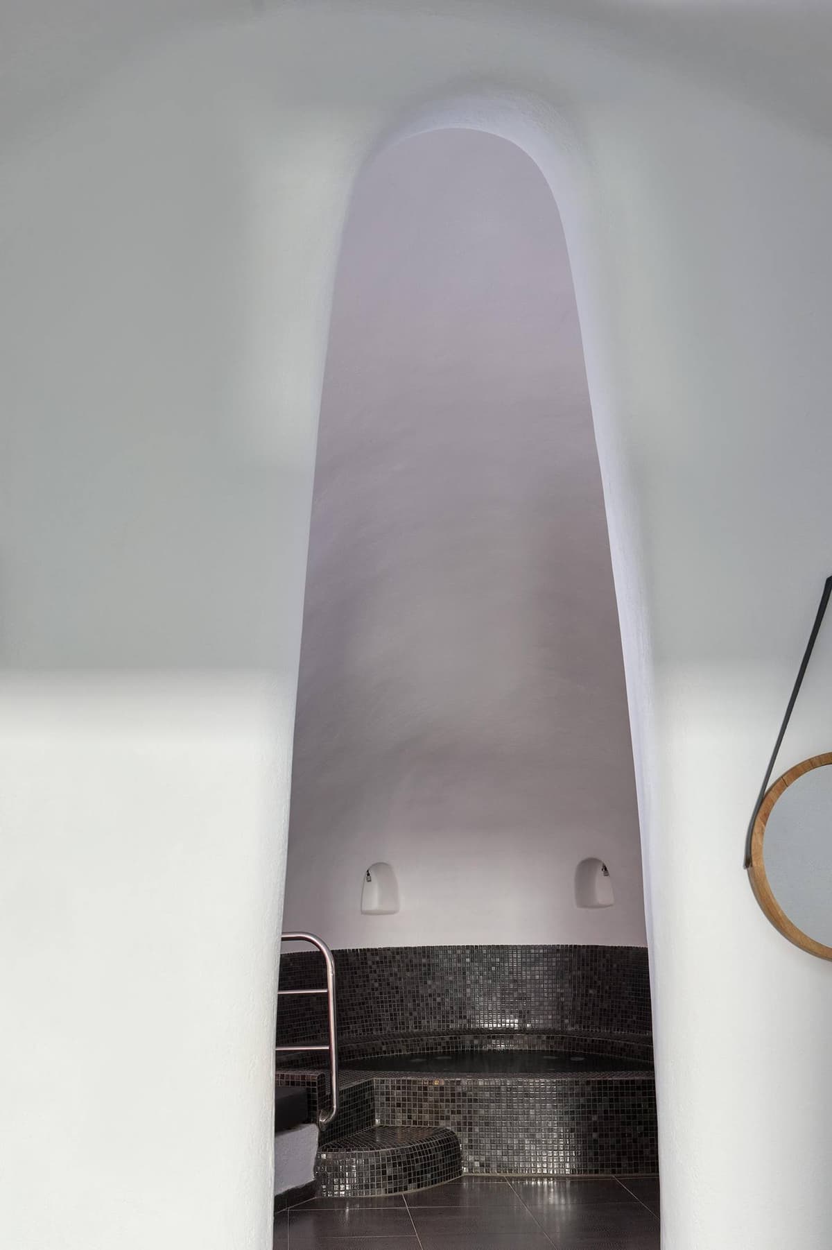
70m² cave suite with heated indoor jacuzzi and arched ceilings.
View room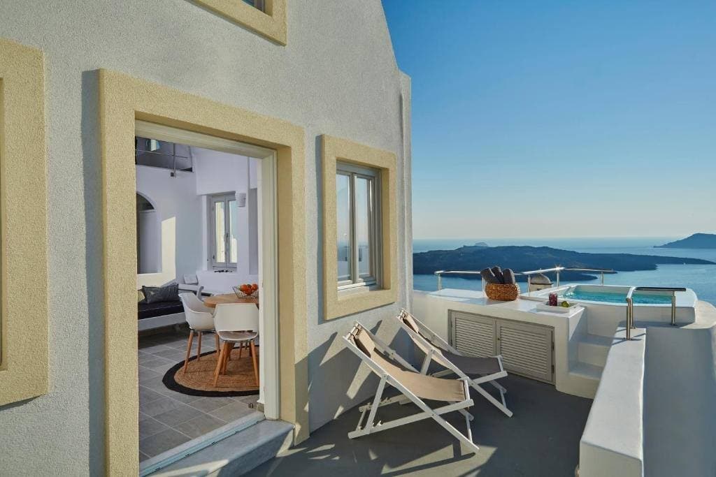
Heated outdoor jacuzzi on your own balcony, with the caldera and the sunset in front of you.
View roomYour Stay Awaits
Experience Santorini from a cave suite perched on the caldera edge in Fira.